God for us to design products, we are the porters of nature!


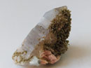
- the Neolithic exploration of silex
The opening of the tunnel of Rossio at the end of the XIX century allowed the discovery, near the railway station of Campolide, of some galleries excavated in the Upper Cretaceous limestones intended for exploration the levels of the silex therein existing.
Paul Choffat, a geologist at the service of Portuguese Geologic Commission, described and illustrated the finding in his work “Etude géologique du Tunnel du Rocio”, published in 1889 in the Memories of that Commission.
This exploration was assigned to the Neolithic period with similar places in many parts of Europe.
The underground galleries developed on two parallel levels to the layers of limestone, reaching several dozens of meters long. Their height ranged from 0.7 to 1 meter, being anchored by pillars carved in the rock.
The excavation was done with the help of basalt masses, which probably would have been tied to a wooden handle and that several specimens were found in the galleries, some already covered by stalagmites.
There were also found some polished stone tools (axes) as well as human remains, which at that time were not possible to collect in time.
Those galleries were destroyed by subsequent railway works.
References:
CHOFFAT, P. (1907) - Exploitation souterraine de silex à Campolide aux temps préhistoriques. O Archeologo Português, Lisboa, 12, p. 338-342.


The mining activity was very intensive at the end of the XIX century. In the urban area were necessary materials for new constructions and for other larger infrastructures, such as the consolidation of the river Tagus bank.
Around the middle of the XX century extractive activities in the current urban area, started to become incompatible with the city growth.
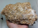
LIMESTONE QUARRIES
- Fornos da República ou Fornos de El-Rei quarry, closed in 1976
- Rio Seco quarry, closed in 1967

In Ajuda, one of the Lisbon parishes, there was several lime quarries from which the stone extraction was made for direct use in construction. One example is the relatively large quarries between Cruzeiro and Rio Seco: Rio Seco and El-Rei quarries.
There are three remaining lime kilns in Lisbon, near Tapada da Ajuda, called "Fornos de El-Rei" and located in the old El-Rei quarry. Their exact dating is still discussed but most probably they are from the second half of the 18th century, contemporaneous to Lisbon rebuild after the 1755 earthquake. Later, in 20th century, another two kilns were built in the vicinity of the quarry.
These two quarries are completely absorbed by the city growth; the locals are still visible through google earth/maps. Start searching with "Travessa dos Fornos, Lisboa"; Rio Seco is on the left and El-Rei is on the top right.


Other inactive registered limestone quarries
I checked the existence of 78 limestone quarries registered in the Lisbon area, dispersed by several parishes, being the large concentration in the parishes of Campolide 12, Alcântara 15 and Benfica 21.
Currently none of the identified quarries is in activity. The great majority of these quarries became, in a subsequent phase, in deposits of rubble and urban waste, or were simply grounded.
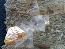
BASALT QUARRIES
- a basalt quarry in the heart of Lisbon

The "Parque Eduardo VII de Inglaterra" is the largest park in the center of the city, being commonly known only to "Parque Eduardo VII". It was named in 1903 in honor of Edward VII of England, who had visited Lisbon last year to reaffirm the alliance between the two countries.
The large green grassy slope that extends for twenty-five acres was opened in the early XX century. In the northwest corner of the park, the place occupied by an old basalt quarry, is now the Cold Greenhouse with a great variety of exotic plants.
I checked the existence of 15 basalt quarries registered in the Lisbon area, all integrated in the Lisbon Volcanic Complex (1) - parishes: Ajuda 2, Alcântara 8, Benfica 1, Campolide 2, Santa Maria de Belém 1, São Sebastião da Pedreira 1.
Currently none of the identified quarries is in activity. The majority of these old quarries became, in a subsequent phase, in deposits of rubble and urban waste or were simply grounded.
(1) This complex was formed 72 million years ago by several important volcanic episodes. The outcrops of the LVC can be seen between Lisbon and Mafra, about 40 km to the north, showing basaltic sheets, tufs, pyroclasts, volcanic breccias, etc, accompanied by a dense net of eruptive dykes.
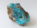
SANDS AND CLAYS
- two essential raw materials for Lisbon urban growth

Sands (for construction works) and clays (for ceramic industry) were explored in the Miocene strata located East of the Lisbon municipality.
There are registers of 132 sand explorations with major concentration in Santa Maria dos Olivais, São João de Brito, Charneca and Lumiar parishes and of 23 clay explorations with major concentration in São Domingos de Benfica, Benfica and Carnide parishes.
Today, only remain names such as “Rua Forno do Tijolo” or “Praça do Areeiro”.
 YueGongAnBei 44051102000467
 |
|